Wloclawek Jerzy Popiełuszko International Airport (EPVW)
AIRPORT DIAGRAM
EPVW
FIELD ELEV
188′
VARIATION
6.7°E
ARP
52°37.8'N 19°09.9'E
RUNWAYS
2
Legend
Runway, hard surface
Taxiway
Apron / ramp
Taxiway name
Connector name
Runway holding position
Building
Control tower
Parking stand
Gate
Helipad
Fuel
Windsock
Rotating beacon
NDB
Runways
RWY
Dimensions
Surface
True / Mag
Lighting & aids
08
5,906 X 131 ft
asphalt
90.0° / 083°
PAPI · REIL · edge · centerline
26
270.0° / 263°
PAPI · REIL
24
5,906 X 98 ft
asphalt
250.0° / 243°
PAPI · REIL
06
70.0° / 063°
PAPI · REIL
Stands: 43 · Helipads: 3 (1 off the diagram)
1 taxiway, apron or building feature lies away from the runways and is not drawn.
ATC routes on the airport's published taxi network and holds aircraft short at every runway exit, painted or not.
Auto-published from the airport design · for Microsoft Flight Simulator only - not for real-world navigation.
Auto-published plate
Wloclawek Jerzy Popiełuszko International Airport (EPVW)
NDB RWY 08
NDB 330 kHz · CWL
NDB
330 kHz CWL
FINAL CRS
083°M
GP / TCH
3.0° / 52′
MDA
700′ (512′)
TDZE
188′
APT ELEV
188′
Missed approach: climb on track 083°M to 3,200′, then RIGHT turn direct CWL NDB and hold, right turns, 1-minute legs, inbound 083°M, maintain 3,200′.Notes: ADF required. The beacon carries no DME - identify NF08 to MAP by timing (table below) or GPS distance. Course reversal at NI08; the missed approach returns to the CWL beacon - the whole procedure flies on the ADF alone.
Plan view · north up · not for navigation
Profile view · not to scale
NF08 to MAP · 5.5 NM
Gnd speed kt
70
90
100
120
140
Time
4:44
3:41
3:19
2:46
2:22
Straight-in minimums
NDB MDA(H)
700′ (512′)
VIS
1,600 m / 1 SM
Runway & lighting
RWY 08
5,906′ · asphalt
Lighting
PAPI
Auto-published from the airport design · for Microsoft Flight Simulator only — not for real-world navigation.
Auto-published plate
Wloclawek Jerzy Popiełuszko International Airport (EPVW)
NDB RWY 26
NDB 330 kHz · CWL
NDB
330 kHz CWL
FINAL CRS
263°M
GP / TCH
3.0° / 52′
MDA
700′ (512′)
TDZE
188′
APT ELEV
188′
Missed approach: climb on track 263°M to 3,200′, then RIGHT turn direct CWL NDB and hold, right turns, 1-minute legs, inbound 263°M, maintain 3,200′.Notes: ADF required. The beacon carries no DME - identify NF26 to MAP by timing (table below) or GPS distance. Course reversal at NI26; the missed approach returns to the CWL beacon - the whole procedure flies on the ADF alone.
Plan view · north up · not for navigation
Profile view · not to scale
NF26 to MAP · 5.5 NM
Gnd speed kt
70
90
100
120
140
Time
4:44
3:41
3:19
2:46
2:22
Straight-in minimums
NDB MDA(H)
700′ (512′)
VIS
1,600 m / 1 SM
Runway & lighting
RWY 26
5,906′ · asphalt
Lighting
PAPI
Auto-published from the airport design · for Microsoft Flight Simulator only — not for real-world navigation.
Auto-published plate
Wloclawek Jerzy Popiełuszko International Airport (EPVW)
NDB RWY 24
NDB 330 kHz · CWL
NDB
330 kHz CWL
FINAL CRS
243°M
GP / TCH
3.0° / 52′
MDA
720′ (519′)
TDZE
201′
APT ELEV
188′
Missed approach: climb on track 243°M to 3,300′, then RIGHT turn direct CWL NDB and hold, right turns, 1-minute legs, inbound 243°M, maintain 3,300′.Notes: ADF required. The beacon carries no DME - identify NF24 to MAP by timing (table below) or GPS distance. Course reversal at NI24; the missed approach returns to the CWL beacon - the whole procedure flies on the ADF alone.
Plan view · north up · not for navigation
Profile view · not to scale
NF24 to MAP · 4.9 NM
Gnd speed kt
70
90
100
120
140
Time
4:10
3:14
2:55
2:26
2:05
Straight-in minimums
NDB MDA(H)
720′ (519′)
VIS
1,600 m / 1 SM
Runway & lighting
RWY 24
5,906′ · asphalt
Lighting
PAPI
Auto-published from the airport design · for Microsoft Flight Simulator only — not for real-world navigation.
Auto-published plate
Wloclawek Jerzy Popiełuszko International Airport (EPVW)
NDB RWY 06
NDB 330 kHz · CWL
NDB
330 kHz CWL
FINAL CRS
063°M
GP / TCH
3.0° / 52′
MDA
720′ (519′)
TDZE
201′
APT ELEV
188′
Missed approach: climb on track 063°M to 3,300′, then RIGHT turn direct CWL NDB and hold, right turns, 1-minute legs, inbound 063°M, maintain 3,300′.Notes: ADF required. The beacon carries no DME - identify NF06 to MAP by timing (table below) or GPS distance. Course reversal at NI06; the missed approach returns to the CWL beacon - the whole procedure flies on the ADF alone.
Plan view · north up · not for navigation
Profile view · not to scale
NF06 to MAP · 4.9 NM
Gnd speed kt
70
90
100
120
140
Time
4:10
3:14
2:55
2:26
2:05
Straight-in minimums
NDB MDA(H)
720′ (519′)
VIS
1,600 m / 1 SM
Runway & lighting
RWY 06
5,906′ · asphalt
Lighting
PAPI
Auto-published from the airport design · for Microsoft Flight Simulator only — not for real-world navigation.
Auto-published plate
Wloclawek Jerzy Popiełuszko International Airport (EPVW)
NDB-A
NDB 330 kHz · CWL · CIRCLING
NDB
330 kHz CWL
FINAL CRS
128°M
GP
3.0° to MDA
MDA(H)
Circle-to-land
TDZE
188′
APT ELEV
188′
Missed approach: climb on track 128°M to 3,200′, then LEFT turn direct CWL NDB and hold, LEFT turns, 1-minute legs, inbound 128°M, maintain 3,200′.Notes: CIRCLING ONLY - the final approach course serves no runway; circle to land visually. ADF required; fly the final by timing (table below). MAP overhead the CWL beacon.
Plan view · north up · not for navigation
Profile view · not to scale
NFA to MAP · 5.0 NM
Gnd speed kt
70
90
100
120
140
Time
4:17
3:20
3:00
2:30
2:09
Circle-to-land minimums (MDA(H) · VIS)
CAT A (<91 kt)
2,500′ (2,312′) · 1 SM
CAT B (91-120 kt)
2,600′ (2,412′) · 1 SM
CAT C (121-140 kt)
2,600′ (2,412′) · 1½ SM
CAT D
NA
Runway & lighting
Longest RWY
5,906′ · asphalt
Lighting
as installed
Auto-published from the airport design · for Microsoft Flight Simulator only — not for real-world navigation.
From the builder
EPVW · in Microsoft Flight Simulator 2024
The story of Wloclawek Jerzy Popiełuszko International Airport
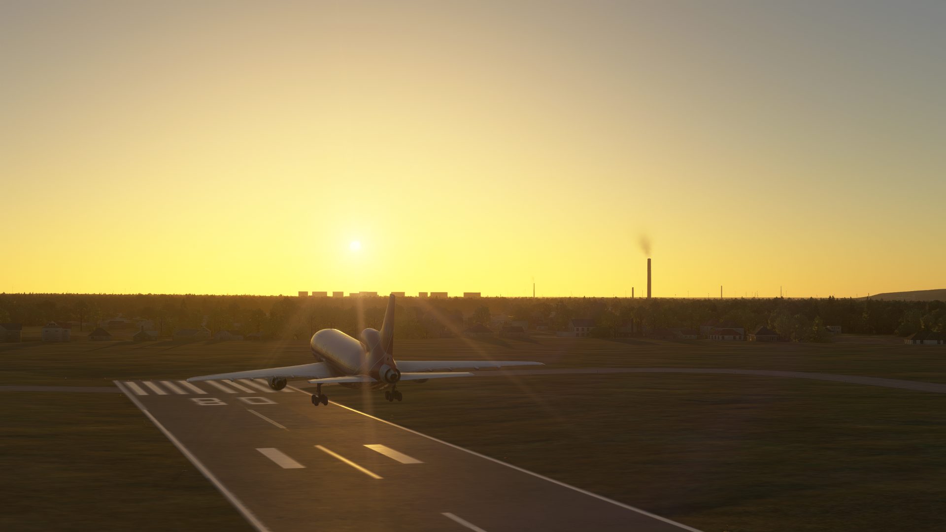
Located near the Wisła river on the outskirts of Włoclawek lays a in progress regional hub to connect Włoclawek with Europe.
Featuring 2 runways positioned best to the wind, with only 1 at the moment being fully tarmac and basic guidance and markings for landing
currently featuring a north biz jet and helicopter park, a heavy cargo apron and a southern GA cargo aprons and hangars to support the building works being carried out.
currently working on
Northern Terminal for pax and cargo ops
Adding PAPI to 06/26
ADDING IFR implementations ie vor dme , rnav, ils
06/26 runway taxiways to asphalt
- Mx771
Field radio
Comments
5 transmissions
N
Newerty EPDB
Been there :)
S
Shepard55
This is a very nice airport. Nice work. It feels real. I love the side hangars with some grass areas and sailplanes.
S
SAVCOM
wow, i thought mine was big, this is massive, what a great job. saw your request for visitors, i need them too. i`m saving for my 2nd a/p
S
SAVCOM
thanks for your visit, reciprocated
S
SAVCOM
your added to my frequent flyer.
Join the field radio
Sign in on the web to comment - Discord isn't required.
Fly Wloclawek Jerzy Popiełuszko International Airport EPVW in your own sim.
Install the free companion app and EPVW - plus every airport on Project Airports - drops straight into Microsoft Flight Simulator 2024 and stays up to date. No SDK, no DevMode, no file wrangling.



Comments
Newerty EPDB
Been there :)
Shepard55
This is a very nice airport. Nice work. It feels real. I love the side hangars with some grass areas and sailplanes.
SAVCOM
wow, i thought mine was big, this is massive, what a great job. saw your request for visitors, i need them too. i`m saving for my 2nd a/p
SAVCOM
thanks for your visit, reciprocated
SAVCOM
your added to my frequent flyer.
Join the field radio
Sign in on the web to comment - Discord isn't required.