3 taxiway, apron or building features lie away from the runways and are not drawn.
ATC routes on the airport's published taxi network and holds aircraft short at every runway exit, painted or not.
Auto-published from the airport design · for Microsoft Flight Simulator only - not for real-world navigation.
Auto-published plate
Lake Saimaa airfield (EFIH)
VOR/DME RWY 04
VOR 109.65 · SAI
VOR
109.65 SAI
FINAL CRS
044°M
GP / TCH
3.0° / 52′
MDA
680′ (467′)
TDZE
213′
APT ELEV
215′
Missed approach: climb on track 044°M to 3,300′, then direct VM04 (SAI DME 5.3) and hold, right turns, 1-minute legs, inbound 044°M, maintain 3,300′.Notes: DME required. All fixes are radial/DME off SAI.
Plan view · north up · not for navigation
Profile view · not to scale
VF04 to MAP · 5.0 NM
Gnd speed kt
70
90
100
120
140
Time
4:17
3:20
3:00
2:30
2:09
Straight-in minimums
VOR/DME MDA(H)
680′ (467′)
VIS
1,600 m / 1 SM
Runway & lighting
RWY 04
2,625′ · asphalt
Lighting
as installed
Auto-published from the airport design · for Microsoft Flight Simulator only — not for real-world navigation.
Auto-published plate
Lake Saimaa airfield (EFIH)
VOR/DME RWY 22
VOR 109.65 · SAI
VOR
109.65 SAI
FINAL CRS
224°M
GP / TCH
3.0° / 52′
MDA
680′ (467′)
TDZE
213′
APT ELEV
215′
Missed approach: climb on track 224°M to 3,300′, then direct VM22 (SAI DME 5.2) and hold, right turns, 1-minute legs, inbound 224°M, maintain 3,300′.Notes: DME required. All fixes are radial/DME off SAI.
Plan view · north up · not for navigation
Profile view · not to scale
VF22 to MAP · 5.0 NM
Gnd speed kt
70
90
100
120
140
Time
4:17
3:20
3:00
2:30
2:09
Straight-in minimums
VOR/DME MDA(H)
680′ (467′)
VIS
1,600 m / 1 SM
Runway & lighting
RWY 22
2,625′ · asphalt
Lighting
as installed
Auto-published from the airport design · for Microsoft Flight Simulator only — not for real-world navigation.
Auto-published plate
Lake Saimaa airfield (EFIH)
VOR-A
VOR 109.65 · SAI · CIRCLING
VOR
109.65 SAI
FINAL CRS
089°M
GP
3.0° to MDA
MDA(H)
Circle-to-land
TDZE
215′
APT ELEV
215′
Missed approach: climb on track 089°M to 3,300′, then LEFT turn direct SAI and hold, LEFT turns, 1-minute legs, inbound 089°M, maintain 3,300′.Notes: CIRCLING ONLY - the final approach course serves no runway; circle to land visually. DME required. MAP at SAI VOR.
Plan view · north up · not for navigation
Profile view · not to scale
VFA to MAP · 5.0 NM
Gnd speed kt
70
90
100
120
140
Time
4:17
3:20
3:00
2:30
2:09
Circle-to-land minimums (MDA(H) · VIS)
CAT A (<91 kt)
580′ (365′) · 1 SM
CAT B (91-120 kt)
680′ (465′) · 1 SM
CAT C (121-140 kt)
680′ (465′) · 1½ SM
CAT D
NA
Runway & lighting
Longest RWY
2,625′ · asphalt
Lighting
as installed
Auto-published from the airport design · for Microsoft Flight Simulator only — not for real-world navigation.
From the builder
EFIH · in Microsoft Flight Simulator 2024
The story of Lake Saimaa airfield
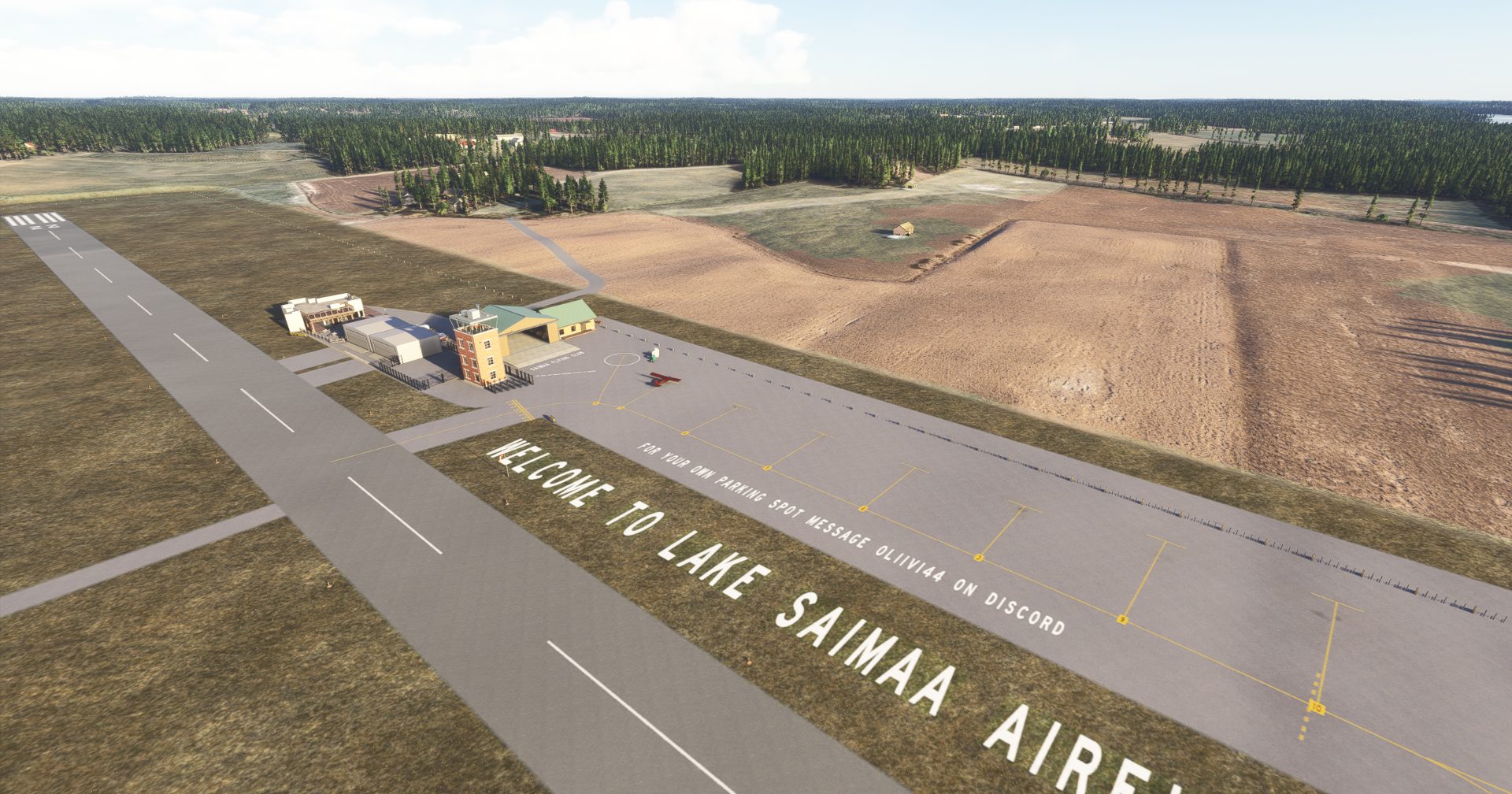
Being a former finnish air force base featuring a paved apron and runway, this airfield is located near one of the most iconic lakes in finland and is a must visit for anyone doing a trip in the area. With a local flying and gliding club, there is a big GA scheme at the airfield. A dock for amphibious aircraft along with 2 camping areas are also located at the airfield.
- Oliivi44
Field radio
Comments
1 transmission
S
SAVCOM
hi, thank you for your visit. What great job you`ve made of this, i like it, and please book me a parking spot. and a seat in the kebab restaurant, love it. added you to my regular list, i hope i can say the same for you at mine SAV1 and VTPW. thank you. see you tomorrow.
Join the field radio
Sign in on the web to comment - Discord isn't required.
Install the free companion app and EFIH - plus every airport on Project Airports - drops straight into Microsoft Flight Simulator 2024 and stays up to date. No SDK, no DevMode, no file wrangling.



Comments
SAVCOM
hi, thank you for your visit. What great job you`ve made of this, i like it, and please book me a parking spot. and a seat in the kebab restaurant, love it. added you to my regular list, i hope i can say the same for you at mine SAV1 and VTPW. thank you. see you tomorrow.
Join the field radio
Sign in on the web to comment - Discord isn't required.