2 taxiway, apron or building features lie away from the runways and are not drawn.
ATC routes on the airport's published taxi network and holds aircraft short at every runway exit, painted or not.
Auto-published from the airport design · for Microsoft Flight Simulator only - not for real-world navigation.
Auto-published plate
Clinton County Airpark (KLTN)
ILS RWY 27
LOC 111.75 · IREL
LOC
111.75 IREL
FINAL CRS
272°M
GS / TCH
3.0° / 52′
DA (CAT I)
670′ (200′)
TDZE
470′
APT ELEV
458′
Missed approach: climb on track 272°M to 3,500′, then direct MA27 (IREL DME 5.5 on the localizer course) and hold, right turns, 1-minute legs, inbound 272°M, maintain 3,500′.Notes: DME or GPS required. Missed-approach hold at MA27 is identified by IREL DME on the localizer course.
Plan view · north up · not for navigation
Profile view · not to scale
Straight-in minimums
CAT I DA(H)
670′ (200′)
RVR / VIS
550 m / 1,800 ft
Runway & lighting
RWY 27
3,937′ · tarmac
Lighting
MALSR · PAPI 3.0° · edge
Auto-published from the airport design · for Microsoft Flight Simulator only — not for real-world navigation.
Auto-published plate
Clinton County Airpark (KLTN)
RNAV (GPS) RWY 27
RNP APCH · LNAV/VNAV
APCH
RNP LNAV/VNAV
FINAL CRS
272°M
GP / TCH
3.0° / 52′
DA (VNAV)
720′ (250′)
TDZE
470′
APT ELEV
458′
Missed approach: climb on track 272°M to 3,500′, then direct RM27 and hold, right turns, 1-minute legs, inbound 272°M, maintain 3,500′.Notes: GPS required.
Plan view · north up · not for navigation
Profile view · not to scale
Straight-in minimums
LNAV/VNAV DA(H)
720′ (250′)
LNAV MDA(H)
870′ (400′)
VIS
1,600 m / 1 SM
Runway & lighting
RWY 27
3,937′ · tarmac
Lighting
PAPI
Auto-published from the airport design · for Microsoft Flight Simulator only — not for real-world navigation.
Auto-published plate
Clinton County Airpark (KLTN)
ILS RWY 35
LOC 111.35 · INAH
LOC
111.35 INAH
FINAL CRS
350°M
GS / TCH
3.0° / 52′
DA (CAT I)
670′ (203′)
TDZE
467′
APT ELEV
458′
Missed approach: climb on track 350°M to 3,500′, then direct MA35 (INAH DME 5.5 on the localizer course) and hold, right turns, 1-minute legs, inbound 350°M, maintain 3,500′.Notes: DME or GPS required. Missed-approach hold at MA35 is identified by INAH DME on the localizer course.
Plan view · north up · not for navigation
Profile view · not to scale
Straight-in minimums
CAT I DA(H)
670′ (203′)
RVR / VIS
550 m / 1,800 ft
Runway & lighting
RWY 35
3,937′ · tarmac
Lighting
MALSR · PAPI 3.0° · edge
Auto-published from the airport design · for Microsoft Flight Simulator only — not for real-world navigation.
Auto-published plate
Clinton County Airpark (KLTN)
RNAV (GPS) RWY 35
RNP APCH · LNAV/VNAV
APCH
RNP LNAV/VNAV
FINAL CRS
350°M
GP / TCH
3.0° / 52′
DA (VNAV)
720′ (253′)
TDZE
467′
APT ELEV
458′
Missed approach: climb on track 350°M to 3,500′, then direct RM35 and hold, right turns, 1-minute legs, inbound 350°M, maintain 3,500′.Notes: GPS required.
Plan view · north up · not for navigation
Profile view · not to scale
Straight-in minimums
LNAV/VNAV DA(H)
720′ (253′)
LNAV MDA(H)
870′ (400′)
VIS
1,600 m / 1 SM
Runway & lighting
RWY 35
3,937′ · tarmac
Lighting
PAPI
Auto-published from the airport design · for Microsoft Flight Simulator only — not for real-world navigation.
From the builder
KLTN · in Microsoft Flight Simulator 2024
The story of Clinton County Airpark
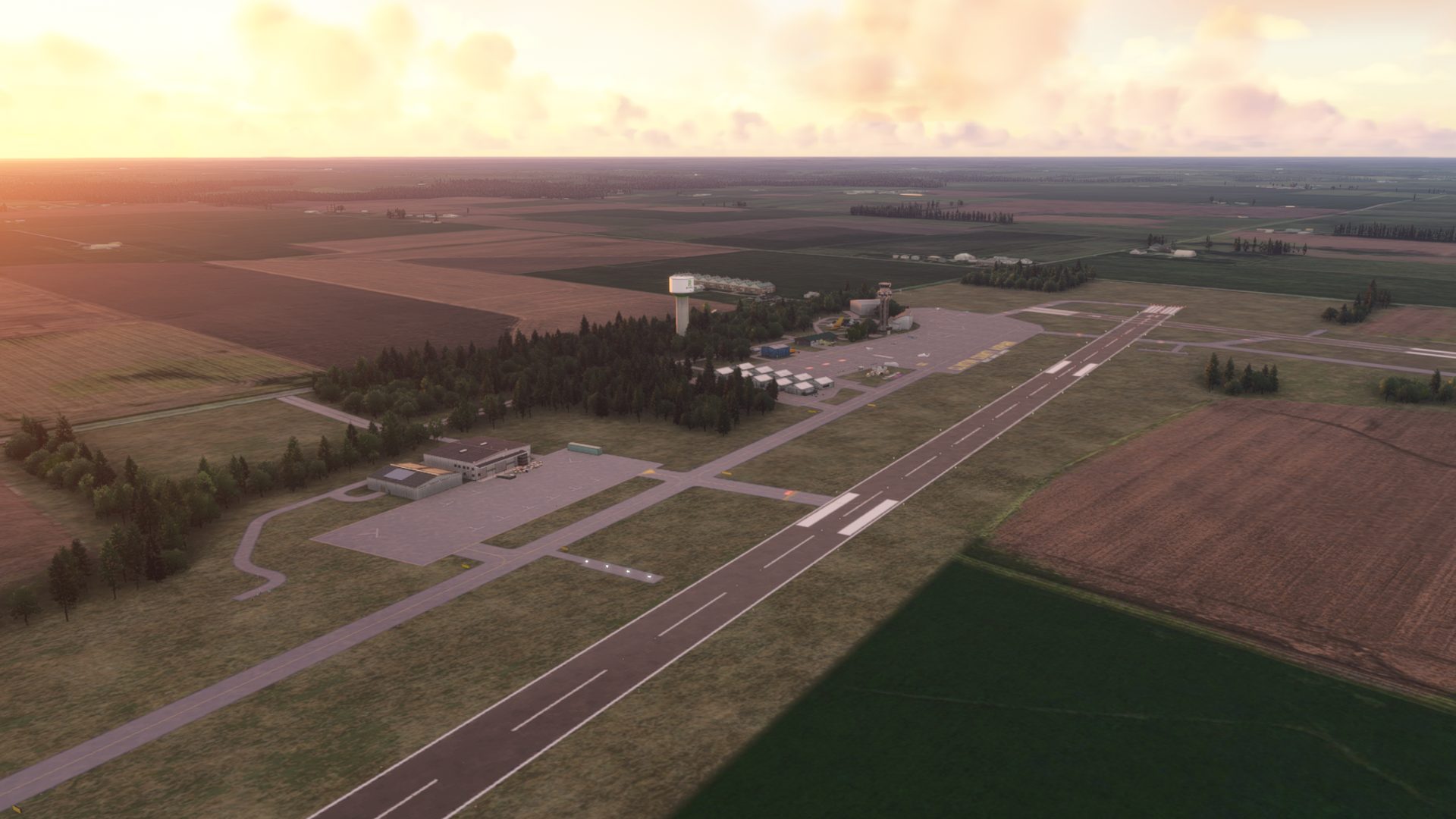
Clinton County Airpark (KLTN) is your gateway to Southern Illinois and the greater Saint Louis area! We are conveniently located just outside of the Saint Louis Metro and right next to the biggest man-made lake in the state!
There is plenty to check out at both the airport itself and the surrounding area!
Enjoy your visit!
Main Approaches: Rwy 27 & 35
RNAV: both main approaches
ILS: both main approaches
Main Rwy: 09-27 (1200m)
Secondary Rwy: 17-35 (1200m)
- DunK1nWx
Field radio
Comments
6 transmissions
S
SAVCOM
hI, saw your request for visitors, i am looking for more as well. SAV1
S
SAVCOM
if you havent already, i thank you in advance for visiting SAV1
D
DunK1nWx
I had to download the region... and I have to say it was worth it! Nice airport!
S
SAVCOM
Thank you, i have all regions open, is their a difference, i don`t see any affect, other than not seeing all the airports, dont see the point of that, your on my regular list now, hope i can be on yours, and we make aero`s
D
DunK1nWx
Of course! You are on my daily list now
S
SAVCOM
That`s great, i need 50k more now, and then i can open my 2nd airport.
Join the field radio
Sign in on the web to comment - Discord isn't required.
Install the free companion app and KLTN - plus every airport on Project Airports - drops straight into Microsoft Flight Simulator 2024 and stays up to date. No SDK, no DevMode, no file wrangling.



Comments
SAVCOM
hI, saw your request for visitors, i am looking for more as well. SAV1
SAVCOM
if you havent already, i thank you in advance for visiting SAV1
DunK1nWx
I had to download the region... and I have to say it was worth it! Nice airport!
SAVCOM
Thank you, i have all regions open, is their a difference, i don`t see any affect, other than not seeing all the airports, dont see the point of that, your on my regular list now, hope i can be on yours, and we make aero`s
DunK1nWx
Of course! You are on my daily list now
SAVCOM
That`s great, i need 50k more now, and then i can open my 2nd airport.
Join the field radio
Sign in on the web to comment - Discord isn't required.