26 taxiway, apron or building features lie away from the runways and are not drawn.
ATC routes on the airport's published taxi network and holds aircraft short at every runway exit, painted or not.
Auto-published from the airport design · for Microsoft Flight Simulator only - not for real-world navigation.
Auto-published plate
La Fournaise Lava Edge (FPIT)
NDB-A
NDB 345 kHz · PIT · CIRCLING
NDB
345 kHz PIT
FINAL CRS
084°M
GP
3.0° to MDA
MDA(H)
Circle-to-land
TDZE
8,070′
APT ELEV
8,070′
Missed approach: climb on track 084°M to 11,100′, then LEFT turn direct PIT NDB and hold, LEFT turns, 1-minute legs, inbound 084°M, maintain 11,100′.Notes: CIRCLING ONLY - the final approach course serves no runway; circle to land visually. ADF required; fly the final by timing (table below). MAP overhead the PIT beacon.
Plan view · north up · not for navigation
Profile view · not to scale
NFA to MAP · 5.0 NM
Gnd speed kt
70
90
100
120
140
Time
4:17
3:20
3:00
2:30
2:09
Circle-to-land minimums (MDA(H) · VIS)
CAT A (<91 kt)
8,420′ (350′) · 1 SM
CAT B (91-120 kt)
8,520′ (450′) · 1 SM
CAT C (121-140 kt)
8,520′ (450′) · 1½ SM
CAT D
NA
Runway & lighting
Longest RWY
722′ · gravel
Lighting
as installed
Auto-published from the airport design · for Microsoft Flight Simulator only — not for real-world navigation.
From the builder
FPIT · in Microsoft Flight Simulator 2024
The story of La Fournaise Lava Edge
“The airstrip ends where the volcano begins.” 🌋✈️
Experience the most impressive bush flight amidst smoke and lava flows.
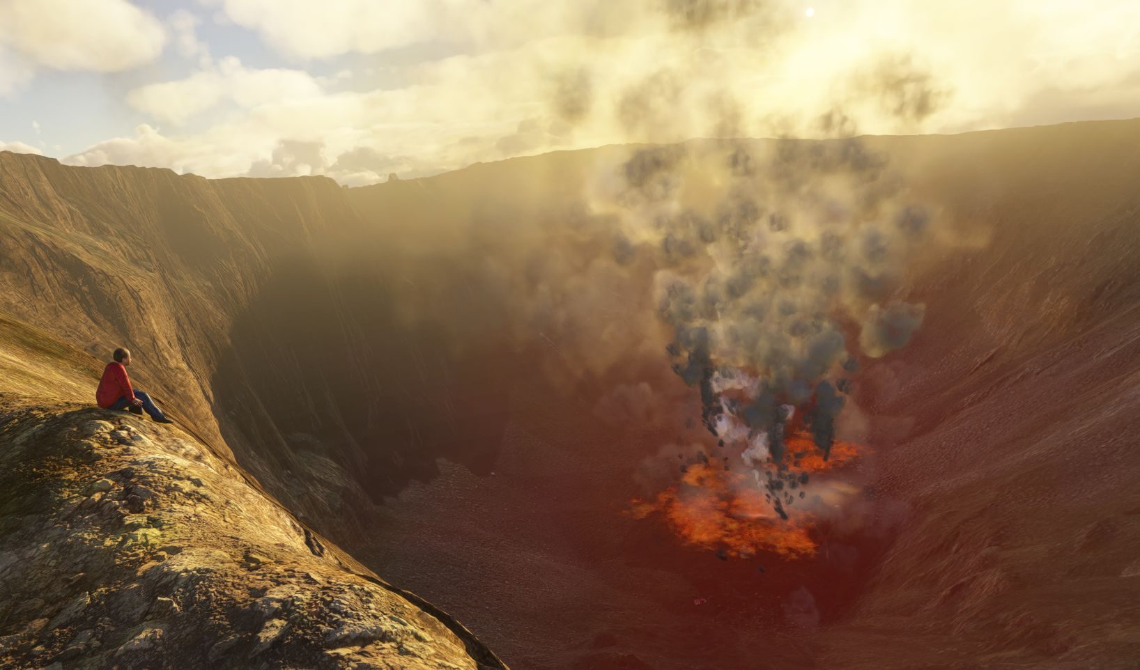
Perched at nearly 2,536 m (8,320 ft) on the edge of the spectacular Bory Crater, FPIT is an extreme bush airfield built for pilots who believe that a landing should be more than just a landing.
Its 250 m (820 ft) luxury volcanic pumice-gravel runway sits dramatically on the very edge of the crater, with the terrain falling away almost immediately beyond the runway. There is no room for a long flare or a late decision. At this altitude, thin air severely reduces aircraft performance, making every takeoff and landing a genuine STOL challenge.
The runway runs roughly SW-NE, taking advantage of the prevailing airflow while allowing approaches through the spectacular volcanic landscape. Winds around the crater rim can be strong and unpredictable, with mountain effects, thermals and turbulence adding another layer of difficulty.
The surroundings are as extreme as the runway itself. The immense Dolomieu crater dominates the skyline, while the vast Enclos Fouqué stretches beneath the aircraft toward the Indian Ocean. Black lava flows, volcanic scoria and barren slopes create an almost otherworldly landscape.
But this is not a museum piece or a forgotten volcanic airstrip. Piton de la Fournaise is an active volcano, and the landscape is constantly shaped by its eruptions. The glow on the horizon is a reminder that the mountain is very much alive.
Facilities are deliberately minimal, you'll have to trust the "smoky" navaid to reach the runway 04. Of course it also acts as a very nice windsock. And don't forget that magnetic variation is +20° on this island when using ADF 345 kHz.
And if you're feeling brave, take the cable car down to see the construction work at the very bottom of the crater. You can also land there by helicopter. A VIP spot awaits you. Needless to say, the temperatures are unbearable.
Welcome la Fournaise Lava Edge Airfield.
- 1L2P
Field radio
Comments
4 transmissions
X
X-Plane Fokker Pilot
Wow, that looks really impressive! Thanks for the 3,5 K Aeros btw!
1
1L2P
Thank you for your visit and your kind comment, and thanks a lot to McCracken for making this event possible, showcasing this airfield.
L
Lima 3K7M EDK9 EDH1
1L2P I really must say I love the detail of your airport, very imersive, and first of all the idea to make it this way, and even the Observer point at the other side of the vulcan
1
1L2P
Thank you for the visit and your comment, I love taking care of the details by trying to have a graphic balance in the scenes and to tell a story while preserving the original sites as best as possible.
Join the field radio
Sign in on the web to comment - Discord isn't required.
Install the free companion app and FPIT - plus every airport on Project Airports - drops straight into Microsoft Flight Simulator 2024 and stays up to date. No SDK, no DevMode, no file wrangling.



Comments
X-Plane Fokker Pilot
Wow, that looks really impressive! Thanks for the 3,5 K Aeros btw!
1L2P
Thank you for your visit and your kind comment, and thanks a lot to McCracken for making this event possible, showcasing this airfield.
Lima 3K7M EDK9 EDH1
1L2P I really must say I love the detail of your airport, very imersive, and first of all the idea to make it this way, and even the Observer point at the other side of the vulcan
1L2P
Thank you for the visit and your comment, I love taking care of the details by trying to have a graphic balance in the scenes and to tell a story while preserving the original sites as best as possible.
Join the field radio
Sign in on the web to comment - Discord isn't required.