
Building Your Airport6 min read
Runways
The runway is the one thing every airport must have, and the tool is built to make a good one fast: pick a template, drag it across the map, and the numbers, markings, and price all sort themselves out.
Drawing a runway
Press R to open the Runway tool, then pick a template card. Now click and dragon the map from one runway end to the other. While you drag, a live tag follows the cursor showing the current length and cost, so you always know what you're about to lay down.
Two modifiers change how the drag behaves: hold Ctrl to lock the heading to neat increments, or hold Shift to place completely freehand with no snapping. In a hurry? A plain click - no drag at all - places the template at its default length.
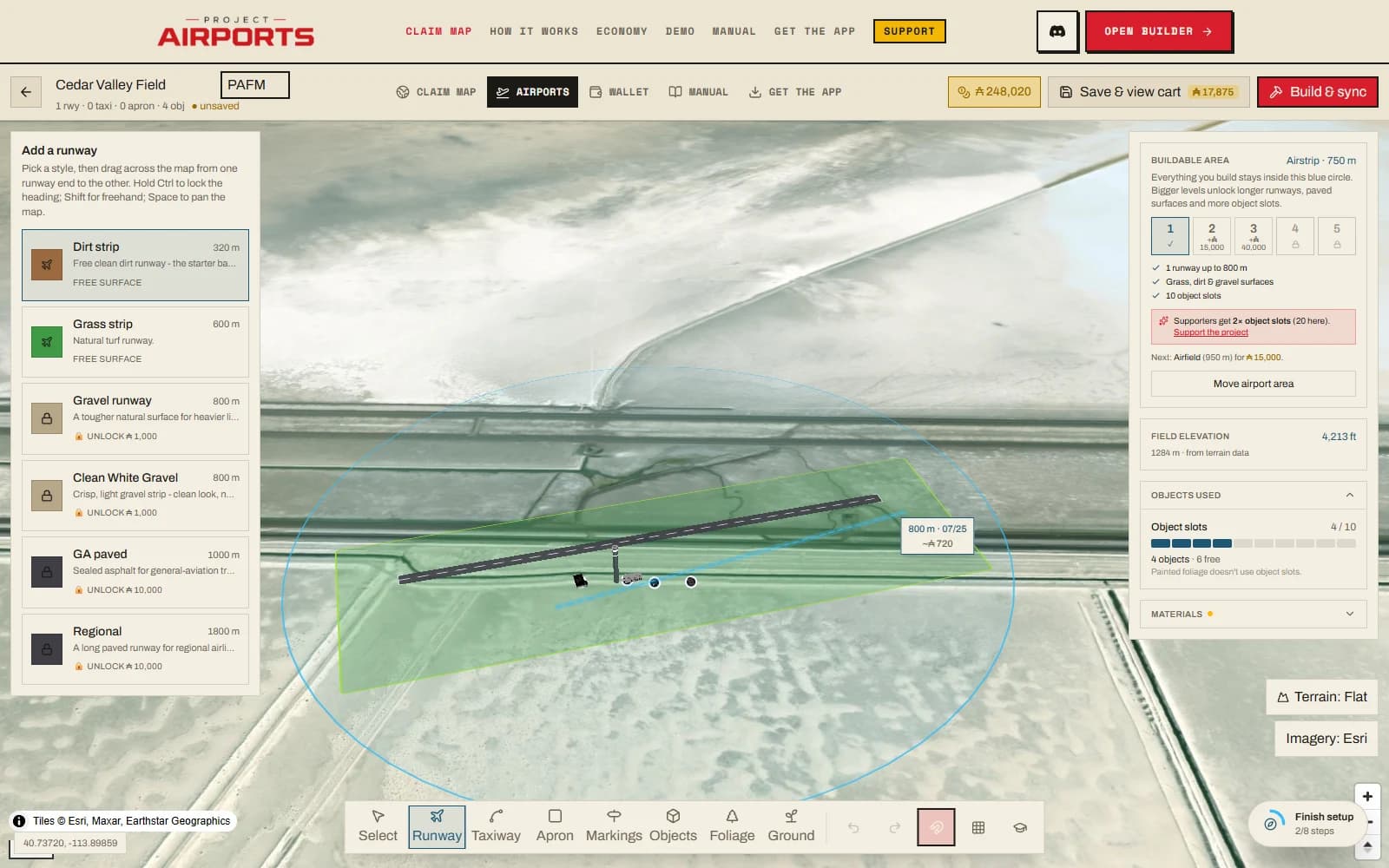
Templates
| Template | Surface | Default size | Notes |
|---|---|---|---|
| Dirt strip | DIRT | 320 × 18 m | Free starter, no markings |
| Grass strip | GRASS | 600 × 23 m | |
| Gravel runway | GRAVEL | 800 × 23 m | |
| Clean White Gravel | GRAVEL | 800 × 23 m | No markings |
| GA paved | ASPHALT | 1000 × 30 m | Edge lines, piano keys & aiming points |
| Regional | ASPHALT | 1800 × 45 m | International paint & touchdown-zone bars |
Templates are starting points - everything is editable afterwards.
Editing
Select a placed runway and its property card gives you sliders for Heading, Length, and Width, plus a surface swatch picker to change what it's made of. Nothing is fixed at placement time - a dirt strip can grow into a paved regional runway whenever your area level and materials allow it.
Numbers & markings
Runway designators - the painted numbers like 09/27 - derive automatically from the heading. You never type them by hand: swing the heading slider and the numbers follow. On painted runways the card notes it plainly: will be marked 09/27 (auto-set from heading).
The Runway markings section adds native MSFS edge lines, threshold bars (the piano keys), fixed-distance aiming points, and touchdown-zone/precision bars. Tick a marking and it appears on the editor map immediately. You can also switch the aiming-point, touchdown and precision scheme between US/FAA and international/ICAO layouts. In both standards the runway numbers follow the piano keys.
Prefer a natural look on a paved surface? Tick Clean surface (no markings). Grass, dirt, and gravel runways are always clean - the checkbox is disabled for them, with the note Grass, dirt & gravel always render as a natural strip - no centerline or numbers.
Limits
The buildable circle
All four corners of a runway are clamped inside the buildable circle. If a drag would poke outside, the runway shrinks to fit - length gives way first, then width - and the status note reads kept inside the buildable area.
Per level
| Area level | Runways | Max length |
|---|---|---|
| L1 Airstrip | 1 | 800 m |
| L2 Airfield | 2 | 1,200 m |
| L3 Regional | 2 | 1,800 m |
Hit the cap and you'll see: Runway limit reached (N) - grow your buildable area to add more.
Elevation
Each runway is flattened to its own sampled elevation, so a strip on a hillside sits level on the ground it actually occupies. The one thing to watch: two runways at very different elevations trigger the two-airport split warning, because MSFS can only flatten one airport to one height. What that means for your build (and your wallet) is covered in Saving, the cart & builds.